High
Altitude Balloon Carrying Amateur Television - 3
HABCAT - 3 On LARG Flight
2004A August 7, 2004
Conducted By The Balloon Committee of the Loudoun Amateur Radio Group of
Northern Virginia
Harper's
Ferry Tracking Site
Reported and Photographed by Norm Styer - AI2C
Tracking
de Harper's Ferry
The Harper's Ferry site is an excellence
tracking location and is actually about 3 miles west at Shipley Elementary
School on the north side of US Route 340. The school sets high above
near terrain with a great view to the west and south of the Blue Ridge
Mountains. So good, in fact that we continued to hear K4LRG/Balloon after
touchdown on North Mountain a few years ago. Oh, OK, back to this story.
I packed up late Friday night, set three
alarm clocks, was up by 0545 hours and was on the road north by
0645 hours. I had a GPS integrated with my dual band Kenwood DM-7V handheld
operating on 144.390 MHz. I was carrying the following gear:
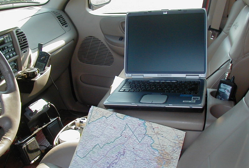
Kenwood
TM-7V Mobile Dual Bander |
Master
Flight Control Manual |
I
was running solo but everything went together quickly and I was up
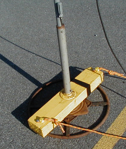
and ready by 0745 hocus. The direction finding antenna sits on top
of two Radio Shack steel masts supported by an adapted Lazy-Boy rotary
base. It's remotely turned by fifty-foot of rope that allows compass
readings to be made away from detracting metal objects and it allows
me to keep an ear on the radios and likewise continually
monitor flight directions and know fairly well where the beacon is.
You never know when something will happen up there.
On this operation reception started
right after it was reported launch; so, the launch site must have been
pretty high. I quickly found that there were two lobes on either side
of the center line and I used both the squelch control and the handle
LARG attenuator unit to find the center line.
At one point I had almost 30-dbs of padding switch in and it was easy
to swing through the pattern and close the squelch on the right point.
After looking at my reported numbers, I think I'll continue with this
technique.
Our good friend, Ray Houff - K4AJA
as K4LRG ran a smooth net on the WA4TSC Repeater. All stations had good
signals into Wes's machine. Tracking reports were made on the fifteen minute
mark and at touchdown.
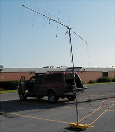
Ready To Go At 0745 Hours
Throughout
the tracking operation I kept a chart on all the numbers
and tried to figure out where the flight was going. I plotted some
data on a Virginia road map.
You could see the effects of the stronger
lower altitude and surface winds; this was really observable
just before touchdown. I didn't notice the peak in signal that we
usually observe at burst. Just prior to loss of signal I had to switch
out all attenuation and within a minute or so it was gone at 1128
hours.
Within fifteen minutes I was on
US 340 South, with plans to drive through Berryville and then east
on Route 50 toward the projected touchdown site south and east of
Marshall. This route would allow me to check both sides and the valley
along the river in case numbers were far off.
Reacquiring the signal was key to
locating the packages. As we now know, but didn't then, there was most
likely a failure in the beacon package at touchdown. The recovery and
search operation is another story and told in another section of this
report.
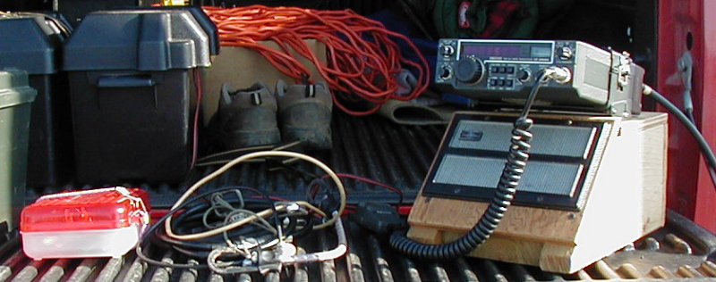
The Tracking Receiver - An ICOM 260A Multi-Mode Transceiver
The Operating Position At AI2C / Mobile
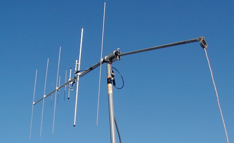
Cushcraft 5-Elements on 2 and 440
Look
Mom, No Hands !!!
Don't throw them out until you've
got the base. This will handle 12 feet of free standing mast and 5
or 6 elements of antenna, and let you turn it remotely. The bar and rope
on the rear of the yagi (above) allows one to adjust elevation since
the antenna is coupled to the mast with an old ratchet handle and a slip
joint. Someday I'll figure out how to put calibrated degree marks
on the ring base and then after surveying it in, just read the bearing.
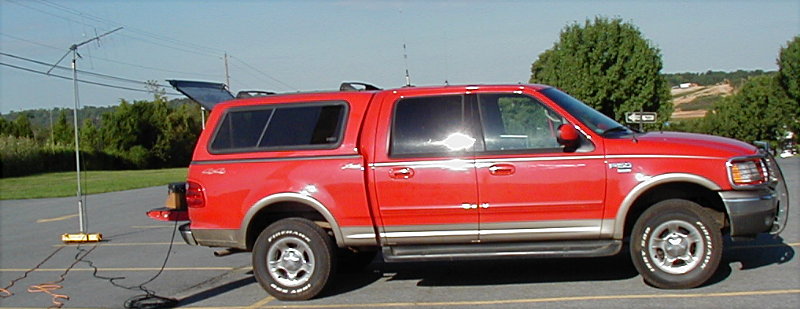
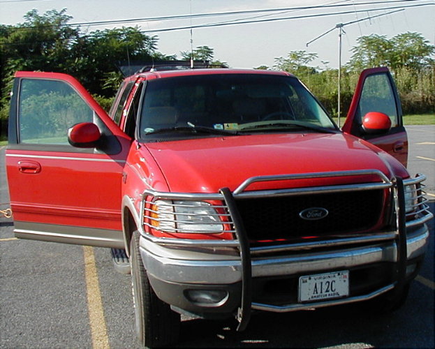
It was a beautiful
day and I enjoyed being out on this operation. And, yes, it's a
nice truck.
Doesn't Ford mean "First On Race Day?" Best Regards, Norm Styer
- AI2C