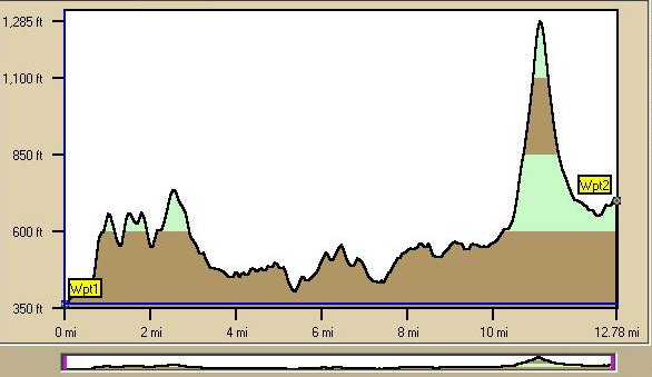
Path Profiles
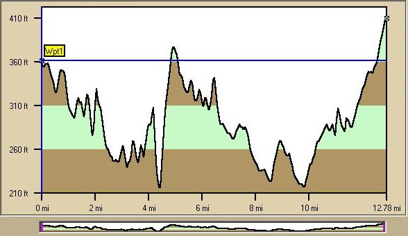
North Profile
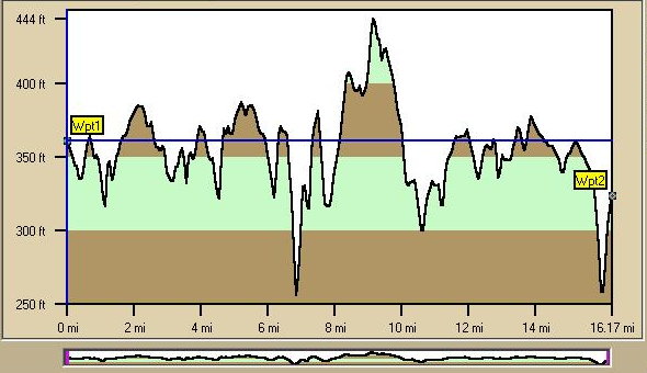
Northeast Profile
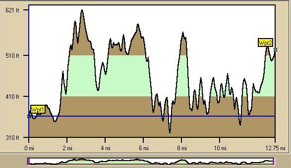
East Profile
Note: Graphic data not printable but available in basic program and used above.
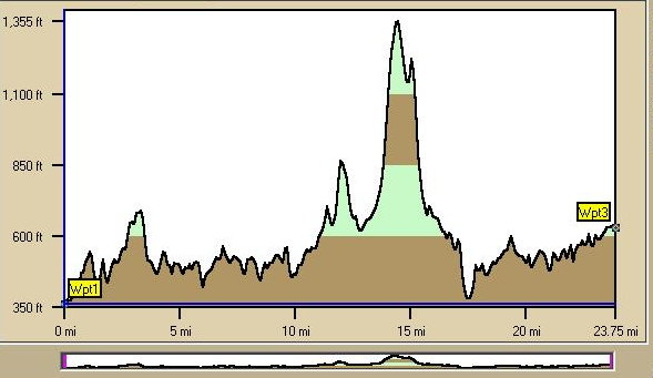
Southeast Profile
South Profile
Southwest Profile
West Profile
Northwest Profile
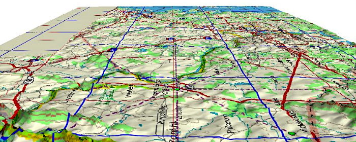
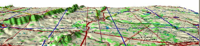
Looking East from Over Western Loudoun
Looking East
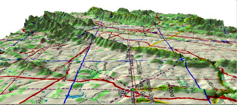
Looking East from Western Loudoun at 51 Degree Pitch
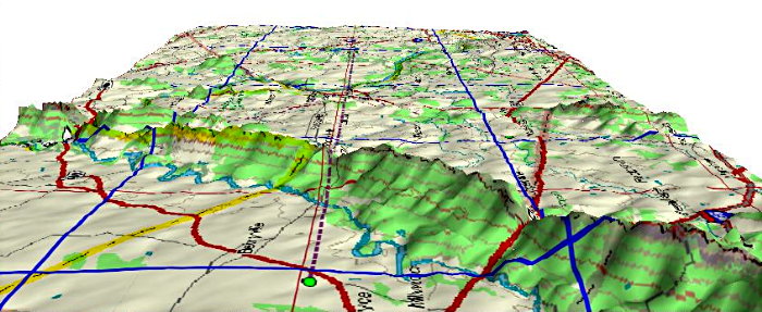
Looking North from Southern Loudoun
Looking Southwest from over Central Maryland
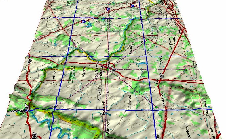
Looking West from North of DC

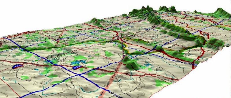
Looking West towards Winchester