High Altitude Balloon Carrying Amateur TV
HABCAT - 2 Flight A Big Success
By The Balloon Committee Of The Loudoun Amateur Radio Group
The Loudoun Amateur Radio Group's second successful flight of 2003 was flown Saturday, 19 July over the Shenandoah and Potomac valleys of Northern Virginia.
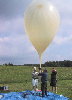
The flight train consisting of the High Altitude Balloon Carrying Amateur TV (HABCAT-2) payload, the veteran "HotChips" instrumentation and beacon payload, a 4-foot parachute lifted by a KAYSAME 1000g latex balloon was released from Gainesboro Virginia at 14:28Z, achieved an altitude of about 83000 feet and was recovered near Lucketts, Virginia.
The launch team consisted of Bill Tincher,
WB3ACC, John Unger, W4AU, and Tom Dawson, WB3AKD. The team was assisted
by Evan Alford, KQ4CI.
In spite of some difficulties associated with
setting up the ground station antennas and receiving equipment, due
primarily to the loss of the AZ-EL positioner somewhere between Round
Hill and Winchester, the flight train was assembled without incident,
and the backup positioner wired up and mounted. The loss of the original
positioner meant that both the VHF and UHF long Yagis were much too
close to each other, and to the positioner, but we did the best we could
with what we had. The primary positioner remains missing.
Fortunately, Gary Quinn, NC4S, was also recording downlinked video from
his home near Lovettsville, Virginia which is fairly close to the touchdown
point so the lack of fully functional GSE at the launch site was not
a critical loss, and useful data was collected as well.
Click Here For Launch Activities
Payload Performance:
Hot Chips:
Hot Chips continued to perform nominally through this, its fourth flight in its current configuration. An anomaly in the battery charging current was discovered about 11:30 PM Friday night which turned out to be a bad cell in one of the Li-ion battery packs. The cell was replaced, and the payload reassembled for a return to normal operation.
HABCAT-2 :
Some attempts had been made to run the ATV payload at 10 watts on the sync tips but the battery life was reduced excessively and the power backed off to 6 watts on the sync tips, which gives about 2 1/2 hours of ATV transmission. The GPS, captioner and transmitter operated nominally throughout the flight. The camera appeared to be producing negative video, although the sync was pretty normal. We'll have to look at the videos and see what was going on. It is possible the camera was overheating, or perhaps it need an IR cut filter. This will be examined in the coming weeks.
The use of 150 lb rated ball bearing swivels in the support lines on either side of the HABCAT payload significantly reduced the spin visible in the video.
There is good agreement between the barometric altitude data and the GPS altitude data. The difference is about 5% at low altitude and about 1 % at the higher altitudes. This is helpful tends to confirms the 100+ thousand foot altitudes achieved in our previous flights where only the Hot Chips altitude data was available.
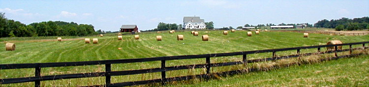
The use of GPS eased the recovery effort as the trackers just programmed the last known coordinated into a waypoint and drive to the landing site which was a small hay field, which also eased recovery. First on the scene was Bruce, KF4KKZ and the rest of the crowd homed in shortly thereafter.
The flight train was laid out in a straight line and the payloads were in good shape. It looked like there was some tangling of the Hot Chips antenna around the payload, and some wrapping of the line between the parachute and balloon remains around the shroud lines. Something to think about for future flights.
Click Here For PDF File Of HABCAT-2 Telemerty Charts
Also Thanks to Stan, K4UEK, for his data file which filled
in a number of gaps.
Participants: Tracking Teams:
Carol, KF4TJJ, Denny, KF4TJI and Ray, K4AJA operated a portable Mission Control from the Blue Ridge several miles south of Snickers Gap.
Tom NA4MA and Dick, W2YE, tracked from North Mountain west of Winchester.
Dave, KG4KZZ and Terry, KI4AZW tracked from Gambrills State Park west of Frederick Md.
Bruce KF4KKZ tracked from near Harpers Ferry WV.
Larry, KC1YC, and Paul N4PD tracked from their respective homes in Leesburg VA.
Charlie, K4LJH tracked from his home in Hamilton and operated a 40-Meter Phone Net with Paul, N4PD to coordinate observations from other amateurs.
Norm, AI2C was at the landing site and took a bunch of pictures. He tracked from Clarkes Gap and tried capturing the downlink video.
Gary, NC4S recorded downlink video and tracked from his home near Lovettsville.
John, KG4L said he woke up late, quickly wired up a downlink monitoring system and tracked from his home in Purcellville.
Pretty much everyone went to the landing site and took a gander at the train as it sat and I got to get a pretty good look at the state it was in after landing, and Norm documented with some pictures.
In spite of the GSE difficulties at the launch site, and the camera anomaly, the flight was quite successful, and everybody had a great time.
We will meet Wednesday, 23 July, in the Robey room of the Purcellville Library to look at the video and plan for the future.
73, Tom - WB3AKD
Chair LARG Balloon Committee
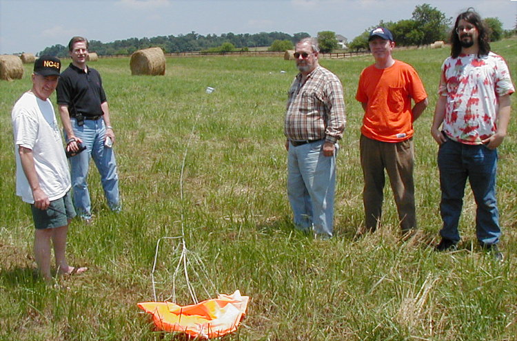
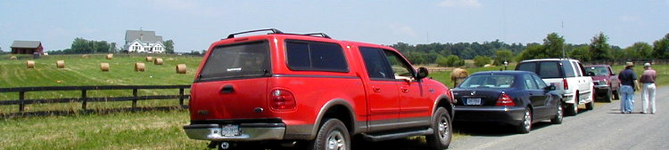
After not finding the property owner,
these fellows made the initial check of the landing site.
L-R: Gary - NC4S, Bruce -KF4KKZ, Dave
- KG4KZZ, Terry - KI4AZW and John - KG4L.
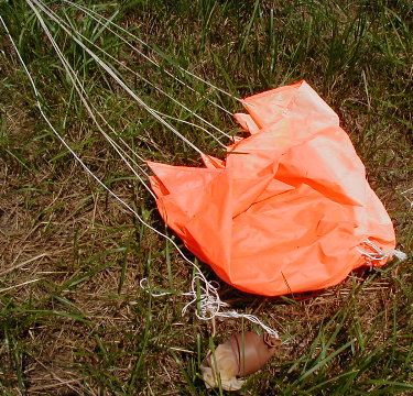
Ole' Reliable Chute With Balloon Stud
Note Balloon - Chute Rope Intanglement
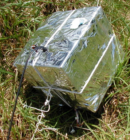
The High Altitude Balloon
Carrying Amateur
TV
Camera Port in Upper Right and
Coax to Antenna Goes Towards The Lower Left.
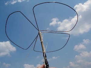
The
HABCAT-2 Transmit Antenna
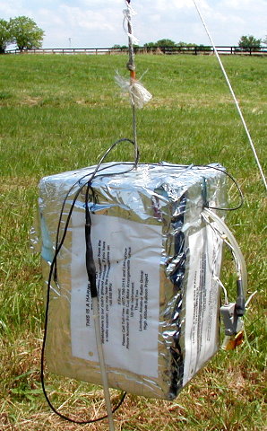
Hot Chips
Operating 145.650 MHz With CW Coded Telemerty
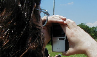
John - KG4L Checks Himself On HABCAT-2
It
Was Still Pumping Out Video
Most Everyone Stopped To Check The Landing and Posed For The
Recovery Crew Photograph
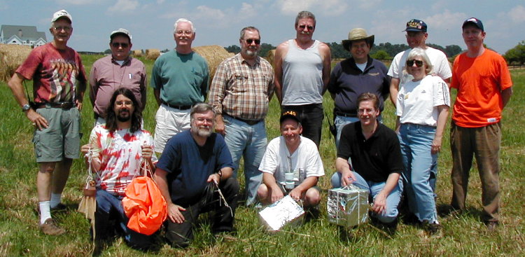
Front L-R: John - KG4L, Tom - WB3AKD,
Gary - NC4S, and Bruce - KF4ZKK
Standing L-R: Norm - AI2C, Larry, KC1YC,
Dick- W2YE, Dave - KG4KZZ, Tom - NA4MA, Paul - N4PD, Carol - KF4YJJ,
Denny - KF4TJI, and Terry, KI4AZW
Photograph Credit Under Your Cursor On Each Photo.
NNNN