K4LRG / Balloon
Flight 2009A

Conducted By The Balloon Committee
of the
Loudoun Amateur Radio Group
of Northern Virginia


This report best displayed with Internet Explorer. This report contains a 640 x 480 video of the launch filmed by Jim Stowers - K4FW and overlaid with a discussion by Tom Dawson - WB3AKD. There are also 4 Windows Media Audio files of this operation integrated into this report. If stuff doesn't play then give it more time to download. Photograph credits are in the file name; just right click. Photographs were provided by John Westerman - WB5ODJ, Jim Stowers - K4FW, Chris Elmer - KD8MEZ, Chris Patton - W3CUM and Norm Styer - AI2C.   Free DHTML scripts provided by Dynamic Drive  Edited and published on K4LRG.ORG by AI2C - Norm Styer.


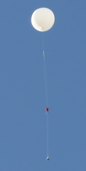
Launch of Flight 2009A. Photograph by Jim Stowers - K4FW of Sterling, VA.

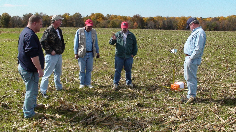
Recovery by John Westernman - WB5ODJ and Dave Putman - KE4S. Photograph by John Westernman - WB5ODJ of Lovettsville, VA.

Down & Found
John Westerman - WB5ODJ and Dave Putman - KE4S
Were First To Arrive At The LZ


       (Purcellville, VA. December 17, 2009)  The Balloon Committee of the Loudoun Amateur Radio Group conducted a very successful launch, tracking and recovery operation of its K4LRG/B Flight 2009A on Sunday, October 25, 2009, in northern Virginia and Maryland. Preparations began in earnest in early August. We flew two payloads 1) the Tom Dawson - WB3AKD K4LRG/B 145.650 MHz CW Beacon and 2) the Mike McBurnett - KJ4KGB APRS Rocket Altimeter. Mike flew his package in preparation for a high altitude rocket flight scheduled for the southwest United States in 2010 or 2011.

       We launch from Harrisonburg, Virginia and recovered the payloads east of Poolesville, Maryland. Launch was at 0932 hours eastern with a 1500 gram balloon. Burst was at 1050 hours at about 95,334 feet. Lost Of Signal (LOS) was at about 1135 hours and recovery teams were on site around 1200 hours. At least twenty-three individuals from several organizations participated in this flight.

The Balloon Committee of the Loudoun Amateur Radio Group
       Flight 2009A Planning Meeting on August 5, 2009


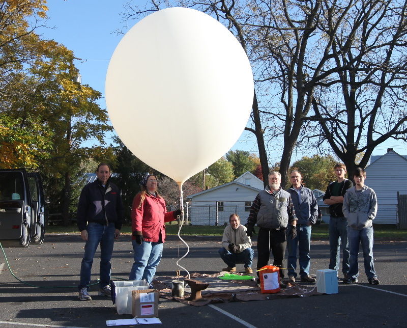
The Balloon Committee of the Loudoun Amateur Radio Group at VFW Post 1177, Leesburg, Virginia, August 2009

(CCW) John Unger - W4AU, Tom Dawson - WB3AKD, Dave Putman - KE4S, Rick Miller - AI1V, Jay Greeley - KI4UTB,
Frank Gentges - K0BRA, Meg Gentges - AI4UX, Doug Johnson - KJ4BRN, Dodson Brown - AJ4EY, Mike McBurnett - KJ4KGB,
Carol Boehler - KF4TJJ, and Denny Boehler - KF4TJI


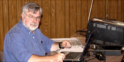
Tom Dawson - WB3AKD, Chairman of the Balloon Committee of the Loudoun Amateur Radio Group. Photograph by Norm Styer - AI2C de Clarkes Gap, VA.

Tom Dawson - WB3AKD
Chairman of the Balloon Committee
of the Loudoun Amateur Radio Group


       Tom Dawson conducted several sessions with the Near Space and Beyond Alliance - A Working Group for Space Explorers - at Shepherd University in West Virginia including assembly of the altimeter payload and the flight train. Several Shepherd University students participated in the launch and they also traveled to the recovery site. Chris Elmer - KD8MEZ's Shepherd University's People and Websites is here. Chris Elmer describes preparation for and the Flight LARG-SUNSBA-1 here. He has photographs of the launch and recovery. Several have been incorporated into this report.

       News about near space activities in local universities is available here.

       Mike McBurnett - KJ4KGB is associated with the Maryland Delaware Rocketry Association Inc. (MDRA). Mike Tyson - N2GEG is associated with high altitude rocket projects.  Information about Mike Tyson is available here.


K4LRG/B Flight 2009A Participants and Roles
Mission Control Launch Operations Tracking & Recovery Operations Home Stations


Jay Ives - KI4TXP

Doug Johnson - KJ4BRN


Suzanne Grobbel

Tom Dawson - WB3AKD

Jim Stowers - K4FW

Gene May - WB8WKU

Chris Elmer - KD8MEZ

Michael Skaggs - Shepherd University

Nathan Smith - Shepherd University


Gambrill State Park, MD.


      Dave Putman - KE4S

      John Westerman - WB5ODJ


Bull Run Mountain, VA.

      Denny Boehler - KF4TJI

      Tom Garasic - NA4MA


Sky Meadows State Park, VA.

      Dodson Brown - AJ4EY

      Ken Sullivan - KJ4GYL


Sherando Park, VA.

      Luther Guise - K5NOB

      Chris Patton - W3CUM


Bent Mountain, VA.

      Jeff Slusher - KE5APC

Rover

      Mike McBurnett - KJ4KGB

      Mike Tyson - N2GEG


Rick Miller - AI1V de Reston, VA.

Charlie Preston - K4LJH de Hamilton,VA.

Norm Styer - AI2C de Clarkes Gap, VA.

Launch Operations at Percell Park, Harrisonburg, Virginia


Launch Site Video 
The following 6-minute Windows Media Video is of the preparation and launch of K4LRG/B Flight 2009A at Harrisonburg, VA. It was filmed by Jim Stowers - K4FW of Sterling, VA. A narrative by Tom Dawson - WB3AKD that he gave to the LARG on the Sunday Night FM Net on the evening of the flight has been integrated during production. You may "Right Click" on the WMV screen and use the "Zoom" Tab to obtain a "Full Screen" display. Afterward, use the Icon in the lower right to return to normal viewing size and continue with the report. You will need a broadband connection and you may have to "Kick Start" it if it pauses during download.


Launch Site Selection
            by WB3AKD - Tom Dawson
 

(Round Hill, VA. - October 22, 2009)
   For those wondering what sort of tea leaf I read to decide on launch site, here's the process I use, and given last year's sudden 90 degree shift in direction, I'm looking at more data than I used to.

First, the program I use is "Balloon Track for Windows" which can be had at http://www.eoss.org/wbaltrak/. The program uses the flight information I input (burst height, ascent and descent rates) and winds data from the NOAA radiosonde system to estimate the ground track of the flight.

Since last year, in addition to the radiosonde data from Dulles, I've been using data from points west to try to see what future winds at Dulles might look like.

Since the jet stream is responsible for most of the horizontal distance traveled by the balloon, looking at jet stream forecasts can provide some insight into what might be going on at launch time.

San Francisco State has interesting weather data including jet stream forecasts at http://squall.sfsu.edu/.

So looking at the predictions for Sunday, from the SFSU site, it looks like the jet stream around here will be running from south west to northeast at about 80 knots. Then, using winds data from Topeka, KS (where the SFSU fate suggested winds of 80 knots were presently blowing) I ran the prediction using that data and our flight profile and get 50 some odd miles travel distance (Topeka winds show a southeasterly track, but winds on Sunday are expected to run northeasterly, around here).

So the best guess I can make based on the available data, is a northeasterly track of about 50 miles which puts the launch site down on I-81 probably Staunton.

I'll be looking for parks and shopping malls for launch sites.

Now excuse me while I go consult the I Ching.

Best Regards, Tom Dawson - WB3AKD


(Round Hill, VA. - October 22, 2009)
   TO ALL: Current jet stream predictions indicate optimum launch sites in either Harrisonburg or Staunton. I'll know better after today's radiosonde data is in.

Objective is to have the balloon land in the Berryville area, although I am inclined to let it drift more north and east of Berryville rather that South and east of Berryville and that "overshoot" area is less densely populated.

If we launch from Staunton, then the site will be Gypsy Hill Park.

If we launch from Harrisonburg, we'll launch from Purcell Park.

Launch team Members please check you directions accordingly.

The following please acknowledge receipt of this message by email:

Chris Elmer, KD9MEZ
Gene May, WB9WKV

any other launch participants.

Best Regards, Tom Dawson - WB3AKD


(Round Hill, VA. - 2302 Hours Eastern, October 22, 2009) 
  TO ALL: Reminders. Launch is approximately 9AM from Harrisonburg VA (Purcell Park).

Flight will consist of Mike, KJ4KGB 's rocket altimeter and an impaired "Hot Chips" variant sending ID only as telemetry processor had a catastrophic failure today and took out the programming pad as well. That will require more time than we had for repair.

Frequencies:

Rocket Altimeter : 145.700 MHz FM APRS format
Hot Chips Beacon 145.65 ID DE K4LRG/6 and a frame number then AR.
Both payload have plenty of battery.

Good hunting to the trackers.

Best Regards, Tom Dawson - WB3AKD


Tracking & Mission Control Operations


Tracking Sites and Assignments
                            by KF4TJI - Denny Boehler

(Leesburg, VA. 1817 Hours Eastern, October 23, 2009)   To All balloon Trackers,

I imagine some or all of you are wondering why I didn't get tracking assignments out earlier. Let me try to give you an idea. I am using the Balloon Tracker program Tom mentioned in his email for the first time. Below is a chart of my results using wind data for IAD obtained from the web.

Date
Bearing
Distance
Time
Max Altitude
18
53
48
102
93
19
174
16
31
24
20
129
14
31
24
21
112
45
110
101
22
103
62
108
99
23
243
29
118
110

Bearing is the bearing from launch site to landing site. Distance is the distance from launch site to landing site. Time is flight time in minutes. Max Altitude is in 1000's for feet. As you can see the flights are varying greatly. Actually Tom has the hardest job, trying to choose a launch site to give a landing site near Berryville.

Tracking locations are listed below and are subject to change with wind changes.

KF4TJI, NA4MA and KJ4BRN
Location: Parking lot near Route 7 &601 (N39 06.933 W77 50.808)

KE4S and WB5ODJ
Location: Gambrill state park northwest of Frederick, MD.

AJ4EY and KJ4GYH
Location: Sky Meadows State Park
From junction of Route 50 & 17 near Paris, VA go south on Route 17 about 2 miles and follow signs. There is an entrance fee for the park. Offers a nice high open spot.

K5NOB and W3CUM
Location: Sherando Park
Locate d on Route 277, Exit 307, about 3 mile east of I-81 near Stevens City

These sites are approximate. Feel free to use a different site in the area if I looks better. I have seen most, but not all of these sites.


Mission Control Notes de Jay Ives - KI4TXP 
I plan on being set up and ready to go no later than 0800. That way we will be able to check out teams as they become available. I will be doing the first time coordination around 0830 and then a formal one about 10 minutes before launch time. At that time I hope to have all the locations from the trackers. Also if the teams would use just one of their calls it would help us out a lot.

I will announce at 1 minute ahead for the team readings. So all will be in sync. I believe that is how we did it last year.

Don't forget the on-the-air meeting Saturday at 7pm on 146.700.

Best Regards, Jay Ives - KI4TXP


Further Information Provided By Denny - KF4TJI.  An incomplete list of possible tracking sites:

Parking lot near Route 7 & 601 (N39 06.933 W77 50.808)

Red Bud Elementary School (N39 11.487 W78 06.803)
Located north of Route 7 east (2-3 miles) of I-81 near Winchester. There is a sign for the school on Route 7. Go north at the traffic light on First Woods road from Route 7.

Farm and Fleet parking lot.
Located north of Route 7 from the first stoplight east of I-81 near Winchester.
This is very close to the school above, but a little closer to the interstate.

West Virginia Welcome Center and Rest Area (N39 06.933 W78 06.803)
Located on I-81 northbound just before milepost 2 in WV.
The main disadvantage to this site is that you have to go 3 miles north to the Route 51 Exit at Inwood, WV to go south on I-81.

Flying J truck stop (N39 17.462 W78 05.143)
Located off I-81 at Exit 323.

Virginia Welcome Center and Rest Stop
Located on southbound I-81near milepost 318.

Comfort Inn parking lot (N39 04.786 W78 12.94)
Located SE of Stevens City Exit 307 on I-81. There are other parking lots in the area that could be used.

Food Lion parking lot (N39 04.804 W78 12.258)
Located on Route 277, Exit 307, about 1 mile east of I-81 near Stevens City

Sherando Park
Located on Route 277, Exit 307, about 3 mile east of I-81 near Stevens City

Ashby Gap (N39 00.843 W77 57.729)
Located on north side of Route 50 at Route 601.

Banneker Elementary School (N39 00.237 W77 47.239)
Located on Snake Hill Rd. about 2 blocks east of Route 611. Snake Hill Rd is about 4-5 miles north of Route 50.

Sky Meadows State Park
From junction of Route 50 & 17 near Paris, VA go south on Route 17 about 2 miles and follow signs.
There is an entrance fee for the park. Offers a nice high open spot.

Best Regards, Denny Boehler - KF4TJI


Mission Control
  
Jay Ives - KI4TXP and Doug Johnson - KI4BRN operated mission control from the Community Park in western part of Berryville, VA. They did a super job of collecting bearing data. They had to stay in contact with the launch team by cell phone. There are no photographs of mission control. Some wonder if they had it all plotted out and could have directed recovery if the altimeter beacon had failed. But all is well that ends well.


Mission Control & Tracking Operations

      This a recording of the Mission Control and Tracking Operations: This wma file is 33.5 minutes in length. This wma file is here if you desire to save a copy via your own player.


K4LRG/B Mission Control and Tracking Net Operations


Tracking Operations Throughout Virginia and Maryland


          Tracking From Reston, Virginia
                            by AI1V - Rick Miller

        (Reston, VA. October 27, 2009)    Hi Folks. I have made my first attempt at a Keyhole Markup Language file. KML is an international standard of the Open Geospatial Consortium. Learn more about KML files here. My file is available here: K4LRG/B Flight 2009A Flight Data For Google Earth By_AI1V  for application on your Google Earth account. [ Editor's Note: The Google Earth Terms of Service prevent reproducing their services.] If you have Google Earth installed, open the file and it will show a three dimension view of the flight path. This is a great program and is well worth the download and disk space. I generated the file using a Python Program that parsed the packets that my system captured on Sunday while I was away. There are a couple of small gaps in the packets, but the path is pretty well represented. I apologies to those of you who actually know KML :) It's fairly primitive.

Best Regards, Rick Miller - AI1V


          Tracking From Bent Mountain, Virginia
                            by KE5APC - Jeff Slusher

        (Bent Mountain, VA. – November 1, 2009)  BENT MOUNTAIN, VA. – Telemetry from the LARG balloon flight of 25 Oct 2009 was copied, at times “loud and clear” from Bent Mountain, Virginia – 111 miles SW of the launch sight until minutes before it landed more than 200 miles away in Poolesville, Maryland. KE5APC recorded audio from frames 92 through 122 when the signal was lost around 1518Z (1118 EDT). His primary station consisted of a Kenwood D710 with dual band antenna mounted in his mobile, parked approximately 3100’ above sea level. His position on the South side of Bent Mountain was unfavorable for copying the balloon but signals as high as 599 were recorded at that location.

This audio file has been edited to delete the majority of white noise between frame reports. It was originally recorded as a wav file, edited using AudaCity software which was also used to create the attached mp3 file. Editor's Note: Converted here to a wma file. It is 10 minutes in length with little signals at the end. This wma file is 2.3 minutes in length. This wma file is here if you desire to save a copy via your own player.


The Bent Mountain Recording of K4LRG/B Flight 2009A

Hearing nothing during the first 20 minutes of the flight, KE5APC walked up the mountain an additional 200 feet where a more favorable Northern exposure was established. He was equipped with a dual band handheld at the higher location and could not record the data. The first frame he copied was frame 35. He also heard a strong packet report on 145.7 Mhz. He descended to his mobile where signals improved, peaking with frame 99 reported as “599.”

APRS data was detected on his D710 but packets could not be decoded.

Best Regards, Jeff Slusher - KE5APC


          Tracking From Canby - Clarkes Gap, Virginia
                            by AI2C - Norm Styer

        (Canby - Clarkes Gap, Virginia – October 25, 2009)   I was still under the influence of some H99N99 stuff; so, I spent the weekend monitoring the progress toward Flight 2009A. On Sunday morning I fired up the station with the intent of monitoring the Altimeter Beacon on UI-View and helping where possible with the tracking. I finally got UI-View working and receiving the Altimeter Beacon packets. It was really strong and solid copy. There were no time hacks recorded and UI-View would not display its location. So, I roughly tracked its progress on maps.

        I also monitored Jay Ives - KI4TXP at Mission Control and all the trackers. It was interesting again to see all the numbers. I managed to record a lot of the Mission Control and Tracking Operation and it is available in the above.wma audio file.
        Here is a particularly interesting signal file of the K4LRG/B payload while on the ground at the Landing Zone. Most folks had good lat-Long data from the Altimeter Beacon so my one and only tracking bearing report was of little consequently except to give encouragement to the Recovery Team that it was still alive out there. This wma file is 2.3 minutes in length. This wma file is here if you desire to save a copy via your own player.


K4LRG/B On Ground Signal Received on Canby Road - Clarkes Gap at AI2C


        I managed to get UI-View working just before burst. Here are the KJ4KGB-1 Packets through almost landing. For what ever reason I have no time hacks. And, you can we Jay Ives - KI4TXP's and Wes Boxwell - WA4TSC's APRS beaconing. Looks like burst was around 029058 meters which is 95,334.645 feet. The last packet recorded showed an altitude of 433 feet. I'm nor sure of the meaning of the packet data between the "W-" and the "/A" altimeter number.

KJ4KGB-1 Rocket Altimeter Packets
Recorded on 145.70 MHz at AI2C
KJ4KGB-1>APBL10,WIDE1-1,WIDE2-1:!3853.36N/07757.41W-095/014/A=027862
KJ4KGB-1>APBL10,WIDE1-1,WIDE2-1:!3853.40N/07757.30W-047/015/A=027959
KI4TXP-9>S9PY7Q,WIDE1-1,WIDE2-1:`jX(l!k>/]"6%}I MONITOR 147.480=
KJ4KGB-1>APBL10,WIDE1-1,WIDE2-1:!3853.44N/07757.19W-096/026/A=028058
KJ4KGB-1>APBL10,WIDE1-1,WIDE2-1:!3853.58N/07756.85W-074/009/A=028361
KJ4KGB-1>APBL10,WIDE1-1,WIDE2-1:!3853.60N/07756.74W-041/021/A=028465
KJ4KGB-1>APBL10,WIDE1-1,WIDE2-1:!3853.62N/07756.61W-057/022/A=028564
KJ4KGB-1>APBL10,WIDE1-1,WIDE2-1:!3853.62N/07756.48W-107/031/A=028662
KI4TXP-9>S9PY7Q,WIDE1-1,WIDE2-1:`jX(l!k>/]"6%}I MONITOR 147.480=
KJ4KGB-1>APBL10,WIDE1-1,WIDE2-1:!3853.60N/07756.33W-083/027/A=028761
KJ4KGB-1>APBL10,WIDE1-1,WIDE2-1:!3853.61N/07756.24W-091/036/A=028862
KJ4KGB-1>APBL10,WIDE1-1,WIDE2-1:!3853.62N/07756.15W-134/022/A=028961
KJ4KGB-1>APBL10,WIDE1-1,WIDE2-1:!3853.65N/07756.04W-114/014/A=029058
KJ4KGB-1>APBL10,WIDE1-1,WIDE2-1:!3853.67N/07755.80W-083/021/A=028358
KI4TXP-9>S9PY7Q,WIDE1-1,WIDE2-1:`jX(l!k>/]"6%}I MONITOR 147.480=
KJ4KGB-1>APBL10,WIDE1-1,WIDE2-1:!3853.75N/07755.61W-039/014/A=027067
KJ4KGB-1>APBL10,WIDE1-1,WIDE2-1:!3853.75N/07755.51W-087/016/A=026454
KJ4KGB-1>APBL10,WIDE1-1,WIDE2-1:!3853.80N/07755.30W-059/015/A=025315
KJ4KGB-1>APBL10,WIDE1-1,WIDE2-1:!3853.82N/07755.23W-062/005/A=024805
KJ4KGB-1>APBL10,WIDE1-1,WIDE2-1:!3853.80N/07755.15W-086/018/A=024366
KJ4KGB-1>APBL10,WIDE1-1,WIDE2-1:!3853.79N/07755.06W-107/009/A=023953
KJ4KGB-1>APBL10,WIDE1-1,WIDE2-1:!3853.83N/07754.91W-037/008/A=023168
KJ4KGB-1>APBL10,WIDE1-1,WIDE2-1:!3853.86N/07754.79W-053/015/A=022428
KJ4KGB-1>APBL10,WIDE1-1,WIDE2-1:!3853.88N/07754.71W-063/019/A=022079
KJ4KGB-1>APBL10,WIDE1-1,WIDE2-1:!3853.94N/07754.64W-074/010/A=021740
KJ4KGB-1>APBL10,WIDE1-1,WIDE2-1:!3853.99N/07754.58W-021/022/A=021412
KJ4KGB-1>APBL10,WIDE1-1,WIDE2-1:!3854.06N/07754.53W-036/016/A=021092
KI4TXP-9>S9PY7Q,WIDE1-1,WIDE2-1:`jX(l!k>/]"6%}I MONITOR 147.480=
KJ4KGB-1>APBL10,WIDE1-1,WIDE2-1:!3854.18N/07754.48W-023/006/A=020463
KJ4KGB-1>APBL10,WIDE1-1,WIDE2-1:!3854.17N/07754.44W-110/013/A=020182
KJ4KGB-1>APBL10,WIDE1-1,WIDE2-1:!3854.18N/07754.32W-079/025/A=019882
KJ4KGB-1>APBL10,WIDE1-1,WIDE2-1:!3854.40N/07753.80W-078/023/A=019014
KI4TXP-9>S9PY7Q,WIDE1-1,WIDE2-1:`jX(l!k>/]"6%}I MONITOR 147.480=
KJ4KGB-1>APBL10,WIDE1-1,WIDE2-1:!3854.44N/07753.65W-068/024/A=018753
KJ4KGB-1>APBL10,WIDE1-1,WIDE2-1:!3854.50N/07753.50W-064/031/A=018498
KJ4KGB-1>APBL10,WIDE1-1,WIDE2-1:!3854.64N/07753.17W-067/036/A=017975
KJ4KGB-1>APBL10,WIDE1-1,WIDE2-1:!3854.71N/07752.98W-061/031/A=017725
KJ4KGB-1>APBL10,WIDE1-1,WIDE2-1:!3854.75N/07752.77W-071/038/A=017480
KJ4KGB-1>APBL10,WIDE1-1,WIDE2-1:!3854.85N/07752.51W-064/056/A=017236
KI4TXP-9>S9PY7Q,WIDE1-1,WIDE2-1:`jX(l!k>/]"6%}I MONITOR 147.480=
KJ4KGB-1>APBL10,WIDE1-1,WIDE2-1:!3854.98N/07752.24W-055/049/A=016997
KJ4KGB-1>APBL10,WIDE1-1,WIDE2-1:!3855.11N/07751.96W-058/058/A=016767
KJ4KGB-1>APBL10,WIDE1-1,WIDE2-1:!3855.27N/07751.66W-053/065/A=016548
KJ4KGB-1>APBL10,WIDE1-1,WIDE2-1:!3855.44N/07751.39W-037/033/A=016325
KJ4KGB-1>APBL10,WIDE1-1,WIDE2-1:!3855.83N/07750.35W-063/079/A=015624
KI4TXP-9>S9PY7Q,WIDE1-1,WIDE2-1:`jX(l!k>/]"6%}I MONITOR 147.480=
KJ4KGB-1>APBL10,WIDE1-1,WIDE2-1:!3856.00N/07750.03W-066/074/A=015382
KJ4KGB-1>APBL10,WIDE1-1,WIDE2-1:!3856.19N/07749.71W-058/069/A=015156
KJ4KGB-1>APBL10,WIDE1-1,WIDE2-1:!3856.39N/07749.34W-047/080/A=014925
KJ4KGB-1>APBL10,WIDE1-1,WIDE2-1:!3856.58N/07748.96W-064/095/A=014714
KJ4KGB-1>APBL10,WIDE1-1,WIDE2-1:!3856.77N/07748.52W-064/066/A=014483
KJ4KGB-1>APBL10,WIDE1-1,WIDE2-1:!3856.99N/07748.12W-051/065/A=014272
KJ4KGB-1>APBL10,WIDE1-1,WIDE2-1:!3857.21N/07747.71W-059/089/A=014072
KI4TXP-9>S9PY7Q,WIDE1-1,WIDE2-1:`jX(l!k>/]"6%}I MONITOR 147.480=
KJ4KGB-1>APBL10,WIDE1-1,WIDE2-1:!3857.49N/07747.30W-051/074/A=013877
KJ4KGB-1>APBL10,WIDE1-1,WIDE2-1:!3857.76N/07746.92W-050/082/A=013673
KJ4KGB-1>APBL10,WIDE1-1,WIDE2-1:!3858.01N/07746.52W-050/101/A=013475
KJ4KGB-1>APBL10,WIDE1-1,WIDE2-1:!3858.74N/07745.22W-052/087/A=012897
KJ4KGB-1>APBL10,WIDE1-1,WIDE2-1:!3859.00N/07744.75W-055/082/A=012716
KI4TXP-9>S9PY7Q,WIDE1-1,WIDE2-1:`jX(l!k>/]"6%}I MONITOR 147.480=
KJ4KGB-1>APBL10,WIDE1-1,WIDE2-1:!3859.60N/07743.80W-041/095/A=012356
KJ4KGB-1>APBL10,WIDE1-1,WIDE2-1:!3859.92N/07743.31W-052/107/A=012170
KJ4KGB-1>APBL10,WIDE1-1,WIDE2-1:!3900.24N/07742.83W-048/108/A=012008
KJ4KGB-1>APBL10,WIDE1-1,WIDE2-1:!3900.59N/07742.37W-042/093/A=011834
KJ4KGB-1>APBL10,WIDE1-1,WIDE2-1:!3901.28N/07741.47W-047/112/A=011479
KI4TXP-9>S9PY7Q,WIDE1-1,WIDE2-1:`jX(l!k>/]"6%}I MONITOR 147.480=
KJ4KGB-1>APBL10,WIDE1-1,WIDE2-1:!3901.63N/07741.03W-045/112/A=011321
KJ4KGB-1>APBL10,WIDE1-1,WIDE2-1:!3902.70N/07739.72W-046/109/A=010786
KJ4KGB-1>APBL10,WIDE1-1,WIDE2-1:!3903.37N/07738.74W-046/110/A=010440
KJ4KGB-1>APBL10,WIDE1-1,WIDE2-1:!3903.71N/07738.22W-048/115/A=010268
KI4TXP-9>S9PY7Q,WIDE1-1,WIDE2-1:`jX(l!k>/]"6%}I MONITOR 147.480=
KJ4KGB-1>APBL10,WIDE1-1,WIDE2-1:!3904.32N/07737.16W-055/097/A=009925
KJ4KGB-1>APBL10,WIDE1-1,WIDE2-1:!3904.94N/07736.12W-055/107/A=009612
KJ4KGB-1>APBL10,WIDE1-1,WIDE2-1:!3905.24N/07735.60W-052/102/A=009453
KJ4KGB-1>APBL10,WIDE1-1,WIDE2-1:!3905.54N/07735.08W-049/096/A=009315
KJ4KGB-1>APBL10,WIDE1-1,WIDE2-1:!3905.83N/07734.59W-048/087/A=009143
KI4TXP-9>S9PY7Q,WIDE1-1,WIDE2-1:`jX(l!k>/]"6%}I MONITOR 147.480=
KJ4KGB-1>APBL10,WIDE1-1,WIDE2-1:!3906.57N/07733.17W-058/090/A=008731
WA4TSC>APU25N:>251343zUI-View32 V2.03
KJ4KGB-1>APBL10,WIDE1-1,WIDE2-1:!3906.93N/07732.37W-056/071/A=008439
KJ4KGB-1>APBL10,WIDE1-1,WIDE2-1:!3907.23N/07731.77W-046/055/A=008159
KJ4KGB-1>APBL10,WIDE1-1,WIDE2-1:!3907.36N/07731.54W-059/056/A=008024
KJ4KGB-1>APBL10,WIDE1-1,WIDE2-1:!3907.68N/07730.96W-050/041/A=007604
KJ4KGB-1>APBL10,WIDE1-1,WIDE2-1:!3907.76N/07730.79W-071/033/A=007466
KJ4KGB-1>APBL10,WIDE1-1,WIDE2-1:!3907.85N/07730.59W-044/035/A=007330
KI4TXP-9>S9PY7Q,WIDE1-1,WIDE2-1:`jX(l!k>/]"6%}I MONITOR 147.480=
KJ4KGB-1>APBL10,WIDE1-1,WIDE2-1:!3908.13N/07729.99W-062/048/A=006928
KJ4KGB-1>APBL10,WIDE1-1,WIDE2-1:!3908.20N/07729.79W-059/045/A=006797
KJ4KGB-1>APBL10,WIDE1-1,WIDE2-1:!3908.27N/07729.37W-054/032/A=006545
KJ4KGB-1>APBL10,WIDE1-1,WIDE2-1:!3908.31N/07729.15W-079/042/A=006425
KJ4KGB-1>APBL10,WIDE1-1,WIDE2-1:!3908.37N/07728.95W-081/041/A=006293
KI4TXP-9>S9PY7Q,WIDE1-1,WIDE2-1:`jX(l!k>/]"6%}I MONITOR 147.480=
KJ4KGB-1>APBL10,WIDE1-1,WIDE2-1:!3908.44N/07728.79W-046/034/A=006190
KJ4KGB-1>APBL10,WIDE1-1,WIDE2-1:!3908.52N/07728.61W-076/042/A=006072
KJ4KGB-1>APBL10,WIDE1-1,WIDE2-1:!3908.59N/07728.46W-083/025/A=005953
KJ4KGB-1>APBL10,WIDE1-1,WIDE2-1:!3908.65N/07728.28W-087/038/A=005830
KJ4KGB-1>APBL10,WIDE1-1,WIDE2-1:!3908.71N/07728.09W-079/036/A=005727
KJ4KGB-1>APBL10,WIDE1-1,WIDE2-1:!3908.77N/07727.92W-052/029/A=005602
KI4TXP-9>S9PY7Q,WIDE1-1,WIDE2-1:`jX(l!k>/]"6%}I MONITOR 147.480=
KJ4KGB-1>APBL10,WIDE1-1,WIDE2-1:!3908.89N/07727.56W-056/041/A=005405
KJ4KGB-1>APBL10,WIDE1-1,WIDE2-1:!3908.96N/07727.39W-051/024/A=005281
KJ4KGB-1>APBL10,WIDE1-1,WIDE2-1:!3909.01N/07727.23W-047/023/A=005168
KJ4KGB-1>APBL10,WIDE1-1,WIDE2-1:!3909.14N/07726.90W-047/023/A=004944
KJ4KGB-1>APBL10,WIDE1-1,WIDE2-1:!3909.31N/07726.59W-054/040/A=004723
KI4TXP-9>S9PY7Q,WIDE1-1,WIDE2-1:`jX(l!k>/]"6%}I MONITOR 147.480=
KJ4KGB-1>APBL10,WIDE1-1,WIDE2-1:!3909.41N/07726.43W-067/041/A=004621
KJ4KGB-1>APBL10,WIDE1-1,WIDE2-1:!3909.48N/07726.26W-051/028/A=004515
KJ4KGB-1>APBL10,WIDE1-1,WIDE2-1:!3909.53N/07726.10W-072/035/A=004407
KJ4KGB-1>APBL10,WIDE1-1,WIDE2-1:!3909.56N/07725.94W-075/016/A=004303
KJ4KGB-1>APBL10,WIDE1-1,WIDE2-1:!3909.64N/07725.63W-048/034/A=004089
KJ4KGB-1>APBL10,WIDE1-1,WIDE2-1:!3909.69N/07725.48W-062/036/A=003993
KI4TXP-9>S9PY7Q,WIDE1-1,WIDE2-1:`jX(l!k>/]"6&}I MONITOR 147.480=
KJ4KGB-1>APBL10,WIDE1-1,WIDE2-1:!3909.73N/07725.34W-082/018/A=003883
KJ4KGB-1>APBL10,WIDE1-1,WIDE2-1:!3909.80N/07725.24W-041/019/A=003769
KJ4KGB-1>APBL10,WIDE1-1,WIDE2-1:!3909.95N/07724.96W-056/036/A=003528
KJ4KGB-1>APBL10,WIDE1-1,WIDE2-1:!3910.01N/07724.81W-081/028/A=003410
KJ4KGB-1>APBL10,WIDE1-1,WIDE2-1:!3910.09N/07724.26W-083/033/A=003083
KJ4KGB-1>APBL10,WIDE1-1,WIDE2-1:!3910.09N/07724.10W-102/033/A=002983
KJ4KGB-1>APBL10,WIDE1-1,WIDE2-1:!3910.06N/07723.97W-092/014/A=002887
KJ4KGB-1>APBL10,WIDE1-1,WIDE2-1:!3910.04N/07723.83W-063/011/A=002793
KJ4KGB-1>APBL10,WIDE1-1,WIDE2-1:!3910.03N/07723.72W-071/025/A=002702
KJ4KGB-1>APBL10,WIDE1-1,WIDE2-1:!3909.99N/07723.37W-057/018/A=002437
KI4TXP-9>S9PY7Q,WIDE1-1,WIDE2-1:`jX(l!k>/]"6&}I MONITOR 147.480=
KJ4KGB-1>APBL10,WIDE1-1,WIDE2-1:!3910.00N/07723.24W-077/008/A=002347
KJ4KGB-1>APBL10,WIDE1-1,WIDE2-1:!3909.99N/07723.01W-147/016/A=002062
KI4TXP-9>S9PY7Q,WIDE1-1,WIDE2-1:`jX(l!k>/]"6&}I MONITOR 147.480=
KJ4KGB-1>APBL10,WIDE1-1,WIDE2-1:!3909.79N/07722.88W-164/002/A=001577
KJ4KGB-1>APBL10,WIDE1-1,WIDE2-1:!3909.73N/07722.87W-147/010/A=001476
KJ4KGB-1>APBL10,WIDE1-1,WIDE2-1:!3909.45N/07722.80W-159/037/A=001205
KJ4KGB-1>APBL10,WIDE1-1,WIDE2-1:!3909.32N/07722.75W-184/025/A=001124
KI4TXP-9>S9PY7Q,WIDE1-1,WIDE2-1:`jX(l!k>/]"6&}I MONITOR 147.480=
KJ4KGB-1>APBL10,WIDE1-1,WIDE2-1:!3909.21N/07722.71W-186/018/A=001038
KJ4KGB-1>APBL10,WIDE1-1,WIDE2-1:!3909.04N/07722.60W-180/005/A=000782
KJ4KGB-1>APBL10,WIDE1-1,WIDE2-1:!3908.99N/07722.56W-170/009/A=000709
KJ4KGB-1>APBL10,WIDE1-1,WIDE2-1:!3908.89N/07722.46W-131/023/A=000538
KI4TXP-9>S9PY7Q,WIDE1-1,WIDE2-1:`jX(l!k>/]"6&}I MONITOR 147.480=
KJ4KGB-1>APBL10,WIDE1-1,WIDE2-1:!3908.83N/07722.41W-143/022/A=000449
KJ4KGB-1>APBL10,WIDE1-1,WIDE2-1:!3908.77N/07722.37W-132/020/A=000359
KJ4KGB-1>APBL10,WIDE1-1,WIDE2-1:!3908.73N/07722.31W-159/016/A=000282
KJ4KGB-1>APBL10,WIDE1-1,WIDE2-1:!3908.69N/07722.29W-201/005/A=000199
KJ4KGB-1>APBL10,WIDE1-1,WIDE2-1:!3908.66N/07722.23W-153/008/A=000132
KI4TXP-9>S9PY7Q,WIDE1-1,WIDE2-1:`jX(l!k>/]"6&}I MONITOR 147.480=
WA4TSC>APU25N:>251343zUI-View32 V2.03
KI4TXP-9>S9PY7Q,WIDE1-1,WIDE2-1:`jX(l!k>/]"6&}I MONITOR 147.480=
 
        Best Regards, Norm Styer - AI2C


Recovery Operations in Montgomery County, Maryland

Landing Zone Recovery Party by John Westernman - WB5ODJ of Lovettsville, VA.

Many Folks Made It Into The Landing Zone
Some Did It The Old Fashion Way And Tracked The 2-Meter CW Beacon While Others Followed Their APRS Unit


Here are a few photographs of the landing zone, recovered payloads, and recovery team. These photographs provided by Chris Patton - W3CUM, John Westerman - WB5ODJ and Shepherd University Space Group. You may right click on a photograph to freeze it and to view credits in the .jpg file name.


Just center the titles and photographs on your screen and let it flip. There are fourteen in this display.


We conducted a Post Flight Brief on the LARG Sunday Night Net with AI1V as Net Control. The following wma audio file has most of the net. It's 56 minutes long. Again, you might choose to slide through the stream. This wma file is here if you desire to save a copy via your own player.


Post Flight 2009A Discussion on the LARG Sunday Night Net

As Tom said,, "All's Well That Ends Well." And, this one launch nicely, was heard well, had a nice APRS beacon, had a smooth landing, and was quickly recovered. And, just in time for lunch. All who participated said they enjoyed it, learned a lot and were glad they took part. Hope to see you all for the next flight. Best Regards, Norm Styer - AI2C de Clarkes Gap, Virginia.

NNNN